Otley Road Cycleway Phase 1 Review: Detailed Analysis – Arthurs Avenue to Harlow Chase
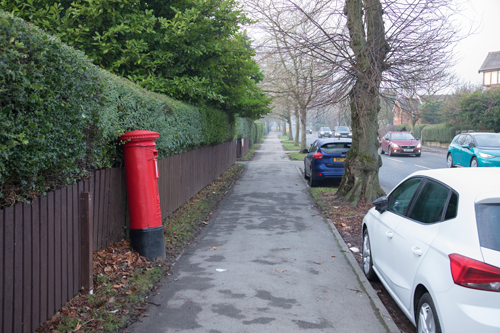
Arthurs Avenue Junction
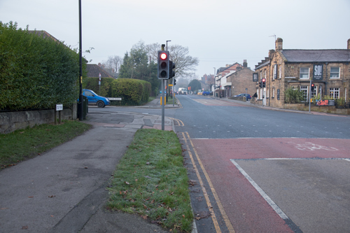
In theory, Phase 1 starts at Arthurs Avenue, but in practice no work has been done on this junction.
Current Design
North Yorkshire’s plan is to send cyclists a short distance up Arthurs Avenue, to wait at a Toucan crossing there with pedestrians. This is not direct, in terms of distance or time. It is a Core Design Principle in the Cycle Infrastructure Design guidance that cycle routes should be at least as direct as those for motor vehicles, and preferably more direct.
A Better Design
A better solution would be to take the small area of grass verge east of Arthurs Avenue, combine it with the existing painted cycle lane, and create a kerb-protected cycle track alongside the road. Cyclists would get a green signal at the same time as motor vehicles. A painted cycle lane would continue across the junction, giving cyclists priority over left-turning vehicles.
Right turns onto Cold Bath Road could be two-stage, using what should become a Toucan crossing opposite So Bar and Eats.
After Arthurs Avenue, the intention is a shared use footway – but there are currently no shared use signs. Shared use is not appropriate in urban areas according to Summary Principle 2 of the guidance, but it is fair to accept that there are space constraints.
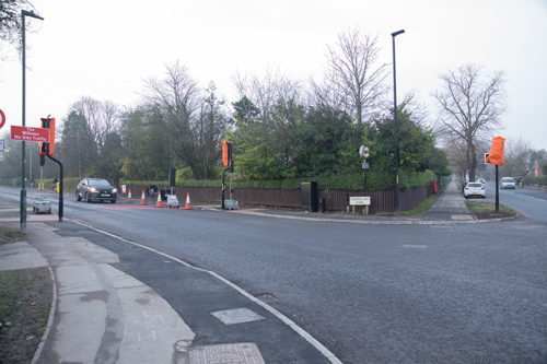
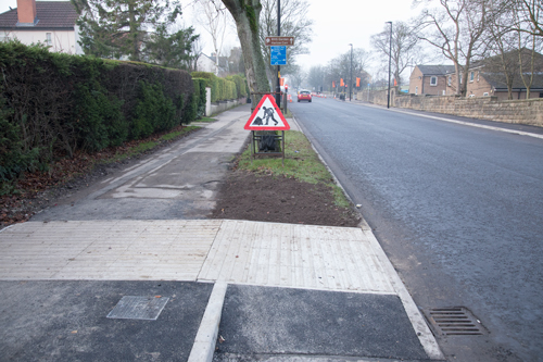
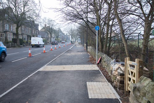
Pannal Ash Road
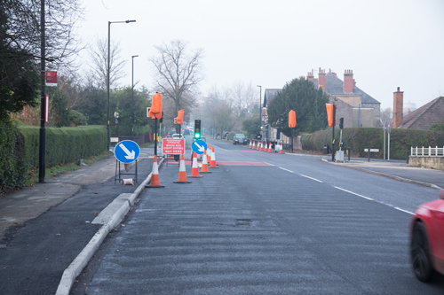
Current Design
Again the design appears to involve a detour to a Toucan crossing of Pannal Ash Road. The lion’s share of green time is given to motor vehicles going straight on on Otley Road and those turning left onto Pannal Ash Road. The current design therefore involves considerable delay to those on bikes.
The designers have left the on-road Advanced Stop Zone as an alternative. This is falling between two stools, by offering two sub-standard options – one safe but not convenient, and the other unsafe but quicker. It would be far better to commit to a single, quality design.
On the south west corner of this junction, the footway has a width of 2m30 – well below the minimum of 3m in the guidance (Table 6-3). As well as the constricted space, this is a blind corner.
A Better Design
A better design would be a kerb-protected cycle track instead of the left-turn lane onto Pannal Ash Road. A painted cycle lane would continue across the junction, giving cyclists priority over left-turning vehicles.
This is an example from the Leeds-Bradford Cycle Superhighway.
The cycle facility continues west of Pannal Ash Road as shared use.
Pannal Ash Drive
North Yorkshire have provided a cycle track/lane with priority over this side road, which is a big improvement over previous designs such as Beckwith Head Road. Update 14th January 2022 – the line painting has now been done.
The width is 1m20, compared with these widths in the guidance (Table 5-2):
- 2m Desirable Minimum
- 1m50 Absolute Minimum
The turn back to the shared use footway is 45 degrees, and the tactile paving immediately before the sharp turn is unhelpful.
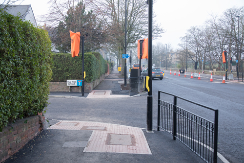
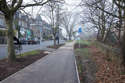
Hill Rise Close
Again, cyclists have priority over Hill Rise Close. The width this time is 1m45. Unfortunately, the line-painting hasn’t been done (update 14th January 2002 – now partly done). Where the cycle track rejoins the footway, it has been left as mud rather than completed.
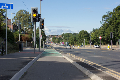
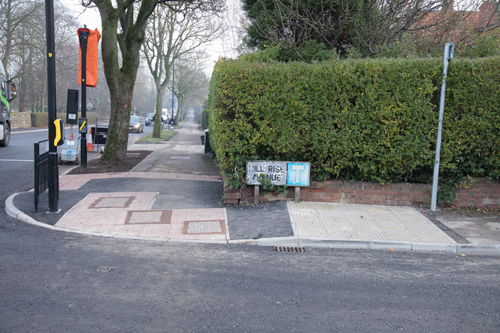
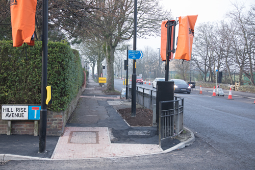
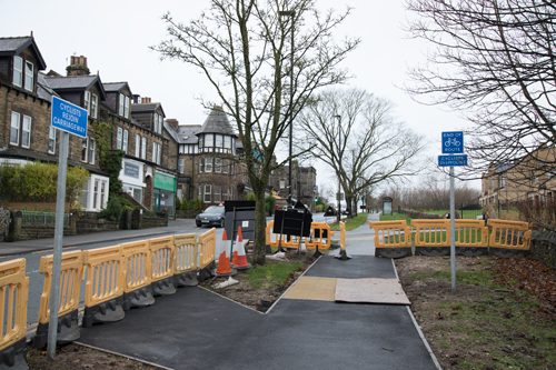
Hill Rise Avenue and Harlow Moor Road Junction
Hill Rise Avenue
Hill Rise Avenue is a minor cul-de-sac at the Harlow Moor Road junction. It seems this is a Toucan crossing.
On the near side of the junction, there are cycling tactile paving stones right next to a kerb. It is very odd and probably a mistake.
The Harlow Moor Road Junction
The Harlow Moor Road junction is the worst part of the whole design.
Extra lanes have been created for motor vehicles – a right turn lane for westbound traffic, which is at least useful, and a left turn lane for eastbound traffic, which is unnecessary.
At least an extra 3m width has been added to the carriageway. The grass verges were removed, and around 8 trees chopped down to achieve this. Local people wrongly blame the loss of these trees on the cycleway.
Meanwhile, the space available for those on foot and on bikes is well below the absolute minimum permitted by the guidance.
It is lamentable and barely believable that in the 4 years the county and its consultants have had to think about this, no one gave a thought to making adequate provision for active travel at this junction.
Cycle Infrastructure Design Guidance
Paragraph 6.1.9 of the guidance states that space for cycling should be created by reallocating space from the carriageway, not reducing the level of service for pedestrians. At this junction, North Yorkshire has done the exact opposite. The county says it is committed to the new Cycle Infrastructure Design guidance. It’s easy to say that, but in practice the guidance is not applied.
The guidance instructs local authorities to be Robin Hood, taking space from motor vehicles and giving it to active travel; North Yorkshire is still acting as the Sheriff of Nottingham.
Current Design
These are the specific problems at the Harlow Moor Road junction:
- it is not immediately clear what westbound cyclists are supposed to do at this junction. A cycling sign has been placed on a lamppost, but it isn’t obvious if you’re asked to cross Otley Road before or after Hill Rise Avenue/Harlow Moor Road. Update 19th January 2022 – it seems you’re supposed to cross Otley Road before Hill Rise Avenue/Harlow Moor Road, because the crossing after is for pedestrians only. This is abysmal design, because it means you have to wait twice, first to cross Otley Road, then to cross Harlow Moor Road
- it makes more sense to cross Otley Road after Harlow Moor Road – but the shared space inside railings on the far side of Hill Rise Avenue is only 1m97 – way below the minimum width for shared space (3m). Grass verge is being reinstated, which given the acute lack of space is not sensible. The lighting column would need to be moved for this space to be usable
- there will be a long wait at this junction, as the lion’s share of green time is given to motor vehicles
A Better Design
A better design for this junction would be to take back carriageway space – as the national guidance instructs – to create a segregated cycle track on the south side of Otley Road with its own signal (that could be push-button operated). It should give green time separate from motor vehicles, to allow cyclists to cross Otley Road to the continuation of the cycle facility on the north side of Otley Road.
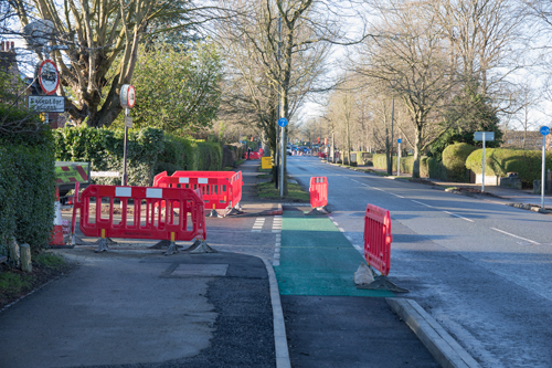
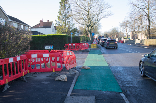
Harlow Moor Road to Harlow Chase
The design here is shared use and two-way cycling for the short distance the cycleway lasts.
At the moment, it’s not useful, because it covers just a few metres before throwing cyclists off, on the wrong side of the road, with no crossing. The next phase west of here should follow as soon as possible.
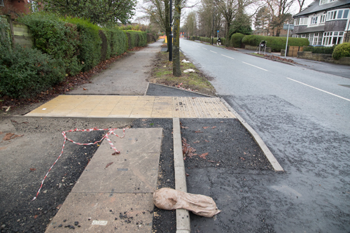
Current Design
The width is 3m40 – enough for segregation of cyclists from pedestrians. It appears from the way the tactile paving is placed that there may be an intention to segregate – but the cycle path seems to be next to the wall, not next to the road, which is odd.
The best way to segregate would be with a difference in level between the two paths, but that opportunity seems to have been missed. The next best would be with a raised strip, trapezoidal in cross section (para. 8.2.5, LTN 1/20).
Phase 1 ends with three signs: CYCLISTS REJOIN CARRIAGEWAY, END OF ROUTE, and CYCLISTS DISMOUNT.
CYCLISTS DISMOUNT and END OF ROUTE signs should not be used.
CYCLISTS DISMOUNT should not normally be used – on a well-designed facility, it is very rarely appropriate, and should only be used where it would be unsafe or impracticable for a cyclist to continue, or at the complete termination of a route (paragraph 13.4.1 of the guidance). ‘There will seldom be a justification for using the sign where a cycle route crosses or joins a carriageway…’
The appropriate signage is only a CYCLISTS REJOIN CARRIAGEWAY sign, appropriately placed, see paragraphs 13.4.2, 13.4.3, and Figure 13.1.
It is crystal clear that this is the wrong signgage, but it is easy to envisage North Yorkshire arguing that black is white, or point-blank refusing to change it without providing any rationale.
You might think, it’s only signage, why does it matter? The problem is that it’s indicative of North Yorkshire’s continuing approach to cycling that includes:
- committing to the guidance in principle but failing to apply it in practice
- putting up CYCLISTS DISMOUNT signs not in very rare and exceptional circumstances, but as a matter of routine, as they always have
- showing a lack of understanding of how people use bikes, and imagining that it’s fine to ask people to stop and get off every few metres
- refusing to actually cycle routes, even though the guidance specifically instructs designers to do so
A Better Design
A better design for the north side of the Harlow Moor Road junction would be to take carriageway space for a segregated cycle track. It would have a green light at the same time as motor vehicles.
This idea is developed on the next page, which is a detailed analysis going downhill from Harlow Chase to Cold Bath Road.
Agree with the analysis – what a mess and waste of money
Hi Imran,
Thanks for the comment. It’s just disappointing that the design is so poor and car-focused.
If the other sections can be built to a better design, including a cycle track out to new housing beyond Harlow Carr, it could still end up as a useful route.
Totally agree, well done for the analysis.
Fundamentally it seems to me that NYCC do not see cyclists as commuters on a valid form of transport, simply as leisure riders prepared to dawdle over journeys on a sunny weekend. Their refusal to even cycle the route says it all
On a purely practical level, surely they should see their mish-mash of styles and inconveniences to cyclists and pedestrians as unsatisfactory ?
No doubt NYCC will be hailing their ‘progess’ as proof of green ambitions, when it could have been so much more. We all need to keep pushing.
I agree. Let’s hope the next phase can be built to a better design.
Have taken a ride round on my trike this morning – starting from Harlow Moor Road shared cycle path. Generally agree with the comprehensive analysis. Pointing out though that the Cyclists Dismount sign before Harlow Chase has been taken down – perhaps because I pointed out the equality implications for inclusive cycling. Will be tweeting this and other points with photos as seems to be no way of including here.
The traffic lights for the left and right turning lanes on Otley Road, at the Harlow Moor Road junction, could surely have been used to allow traffic going straight-on to continue and for cyclist to cross Harlow Moor Road at the same time? It was practically impossible for me to reach the Toucan crossing button when waiting to cross northwards there given that I cannot stand and manipulate my trike. Again an equality failure.
I walked along Otley Road several times during November, December and January as construction was taking place. I started off feeling optimistic that at last we were going to get the long awaited Cycleway, but then optimism turned to pessimism as the construction progressed and I saw more and more improvements taking place to the road, with little evidence of new cycle paths on either side. Your excellent analysis of the end result confirms my feelings. I doubt if I will be using the new Cycleway, as cycling on Otley Road will be much quicker especially when the shared pavements in the vicinity of Harrogate Grammar School are overcrowded with pupils at the start and end of the school day.
When I attended public meetings in Harrogate Grammar School 4 years ago, and discussed the plans with councillors, I was aware the Cycleway was going to be a mixture of cycle lanes and shared usage pavements, but I was under the impression we were going to have something much better than what has been delivered: something that would look like a cycle path! I feel that the funding has been used primarily to improve Otley Road for motor vehicles by widening various junctions, and improving road surfaces, and by getting cyclists out of the way. What has been delivered for cyclists is completely substandard and inadequate as your analysis shows. Have NYCC used the funding exactly as planned, or have their plans been modified once the funding was obtained? Dare I ask: has funding been misappropriated?
I know this is just Phase 1, and we are being urged to reserve judgement until the full Cycleway route is completed, but sadly I have no confidence NYCC will deliver anything better in later phases unless they are called to account over the delivery of Phase 1, which seems to break all of the Cycle Infrastucture Design Guidelines.
Hi Eric, Thanks for your comment. I agree the key thing now is to learn lessons so as to build to a better design in future phases.